咨询与建议

限定检索结果

文献类型

  • 936 篇 会议
  • 106 册 图书

馆藏范围

  • 1,040 篇 电子文献
  • 2 种 纸本馆藏

日期分布

学科分类号

  • 854 篇 工学
    • 686 篇 测绘科学与技术
    • 608 篇 计算机科学与技术...
    • 47 篇 信息与通信工程
    • 46 篇 环境科学与工程(可...
    • 27 篇 城乡规划学
    • 14 篇 水利工程
    • 5 篇 地质资源与地质工...
    • 3 篇 仪器科学与技术
    • 3 篇 建筑学
    • 1 篇 电子科学与技术(可...
    • 1 篇 控制科学与工程
  • 712 篇 理学
    • 539 篇 地理学
    • 172 篇 地球物理学
    • 23 篇 地质学
    • 1 篇 数学
    • 1 篇 大气科学
    • 1 篇 统计学(可授理学、...
  • 71 篇 历史学
    • 71 篇 世界史
  • 21 篇 医学
    • 21 篇 公共卫生与预防医...
  • 4 篇 管理学
    • 4 篇 公共管理

主题

  • 58 篇 geographical inf...
  • 49 篇 gis
  • 25 篇 earth sciences, ...
  • 25 篇 maps
  • 20 篇 ontology
  • 18 篇 lidar
  • 15 篇 citygml
  • 13 篇 mapping
  • 11 篇 geographic infor...
  • 10 篇 volunteered geog...
  • 10 篇 navigation
  • 10 篇 urban planning
  • 9 篇 semantics
  • 9 篇 linked data
  • 9 篇 disaster managem...
  • 8 篇 data integration
  • 8 篇 information syst...
  • 8 篇 computer applica...
  • 8 篇 spatial cognitio...
  • 8 篇 visualization

机构

  • 13 篇 univ munster ins...
  • 10 篇 ras st petersbur...
  • 7 篇 swiss fed inst t...
  • 6 篇 univ munster ins...
  • 6 篇 delft univ techn...
  • 6 篇 delft univ techn...
  • 5 篇 eotvos lorand un...
  • 5 篇 naval academy re...
  • 5 篇 russian acad sci...
  • 4 篇 tum tum sch engn...
  • 4 篇 wuhan univ sch r...
  • 4 篇 univ appl sci hm...
  • 4 篇 leibniz univ han...
  • 4 篇 vsb tech univ os...
  • 4 篇 inst social sci ...
  • 4 篇 palacky univ olo...
  • 4 篇 tech univ munich...
  • 4 篇 department of hi...
  • 4 篇 mit dept urban s...
  • 3 篇 finnish geospati...

作者

  • 9 篇 osaragi toshihir...
  • 9 篇 raubal martin
  • 8 篇 kuhn werner
  • 8 篇 zlatanova sisi
  • 8 篇 stoter jantien
  • 8 篇 van oosterom pet...
  • 7 篇 doellner juergen
  • 7 篇 frank andrew u.
  • 7 篇 haunert jan-henr...
  • 7 篇 manfred schrenk
  • 7 篇 schwering angela
  • 7 篇 kolbe thomas h.
  • 7 篇 kessler carsten
  • 7 篇 sisi zlatanova
  • 6 篇 scheider simon
  • 6 篇 timpf sabine
  • 6 篇 georg gartner
  • 6 篇 kray christian
  • 6 篇 jonietz david
  • 6 篇 levachkine sergu...

语言

  • 1,031 篇 英文
  • 11 篇 中文
检索条件"丛书名=Lecture Notes in Geoinformation and Cartography"
1042 条 记 录,以下是601-610 订阅
排序:
Road Network Conflation: An Iterative Hierarchical Approach  11th
Road Network Conflation: An Iterative Hierarchical Approach
收藏 引用
11th International Symposium on Location Based Services
作者: Hackeloeer, Andreas Klasing, Klaas Krisp, Jukka Matthias Meng, Liqiu Tech Univ Munich Dept Cartog Arcisstr 21 D-80333 Munich Germany BMW Forsch & Tech GmbH D-80992 Munich Germany Univ Augsburg Dept Geog D-86135 Augsburg Germany
Road Network Conflation is concerned with the unique identification of geographical entities across different road networks. These entities range from elemental structures such as crossings represented by nodes in the... 详细信息
来源: 评论
Automated Generation of Indoor Accessibility Information for Mobility-Impaired Individuals  18th
Automated Generation of Indoor Accessibility Information for...
收藏 引用
18th Association-of-Geographic-Information-Laboratories-for-Europe Conference on Geographic Information Science (AGILE)
作者: Kostic, Nemanja Scheider, Simon Univ Munster Inst Geoinformat Heisenbergstr 2 D-48149 Munster Germany Swiss Fed Inst Technol Inst Kartog & Geoinformat CH-8093 Zurich Switzerland
One important issue in developing assistive navigation systems for people with disability is the accuracy and relevancy of the systems' knowledge bases from the perspective of these special user groups. The theory... 详细信息
来源: 评论
Experimental Comparison of Sequential and Global Modelling Methods of Subsurface Horizon Sequence
Experimental Comparison of Sequential and Global Modelling M...
收藏 引用
GIS Ostrava Compilation Surface Models for Geosciences.
作者: Vizi, Ladislav Bencokova, Maria Tech Univ Kosice Inst Geosci Fac BERG Pk Komenskeho 15 Kosice 04200 Slovakia
The objective of the presented paper is to compare two spatial modelling approaches for the boundary surfaces of a geological subsurface structure, where the exact depth locations of the modelled horizons are known on... 详细信息
来源: 评论
Feature Selection in Conditional Random Fields for Map Matching of GPS Trajectories  11th
Feature Selection in Conditional Random Fields for Map Match...
收藏 引用
11th International Symposium on Location Based Services
作者: Yang, Jian Meng, Liqiu Tech Univ Munich Lehrstuhl Kartog D-80333 Munich Germany
Map matching of the GPS trajectory serves the purpose of recovering the original route on a road network from a sequence of noisy GPS observations. It is a fundamental technique to many Location Based Services. Howeve... 详细信息
来源: 评论
Visualization and Communication of Indoor Routing Information  11th
Visualization and Communication of Indoor Routing Informatio...
收藏 引用
11th International Symposium on Location Based Services
作者: Krisp, Jukka M. Jahnke, Mathias Lyu, Hao Fackler, Florian Univ Augsburg Dept Geog Alter Postweg 118 D-86159 Augsburg Germany Tech Univ Munich Dept Cartog D-80333 Munich Germany
In this paper we investigate the display and communication of indoor routing instructions via small maps, map-like graphics and non-photorealistic presentations of interior spaces. Our goal is to elaborate on question... 详细信息
来源: 评论
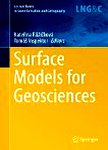
Surface Models for Geosciences  1
收藏 引用
丛书名: lecture notes in geoinformation and cartography
2015年
作者: Kateřina Růžičková, Tomáš Inspektor (eds.)
The aim of the conference is to present and discuss new methods, issues and challenges encountered in all parts of the complex process of gradual development and application of digital surface models. This process cov...
来源: 评论
Towards Real-Time Processing of Massive Spatio-temporally Distributed Sensor Data: A Sequential Strategy Based on Kriging  18th
Towards Real-Time Processing of Massive Spatio-temporally Di...
收藏 引用
18th Association-of-Geographic-Information-Laboratories-for-Europe Conference on Geographic Information Science (AGILE)
作者: Lorkowski, Peter Brinkhoff, Thomas Jade Univ Appl Sci Wilhelmshaven Oldenburg Elsfle IAPG Ofener Str 16-19 D-26121 Oldenburg Germany
Sensor data streams are the basis for monitoring systems which infer complex information like the excess of a pollution threshold for a region. Since sensor observations tend to be arbitrarily distributed in space and... 详细信息
来源: 评论
Surveying of Small Water Reservoirs for Water Management Purposes
Surveying of Small Water Reservoirs for Water Management Pur...
收藏 引用
GIS Ostrava Compilation Surface Models for Geosciences.
作者: Fuska, Jakub Barek, Viliam Slovak Univ Agr Fac Hort & Landscape Engn Dept Landscape Engn Hospodarska 7 Nitra 94976 Slovakia
Small water reservoirs are important part of the landscape that is changing under various anthropogenic and natural processes. Knowledge of the actual parameters, such as actual water reservoir storage capacity or the... 详细信息
来源: 评论
DTM Impact on the Results of Dam Break Simulation in 1D Hydraulic Models
DTM Impact on the Results of Dam Break Simulation in 1D Hydr...
收藏 引用
GIS Ostrava Compilation Surface Models for Geosciences.
作者: Jancikova, Andrea Unucka, Jan Katastralni Urad Jeremenkova 110-15 Olomouc 77211 Czech Republic Czech Hydrometeor Inst K Myslivne 3-2182 Ostrava 70800 Czech Republic VSB Tech Univ Ostrava Fac Min & Geol Ostrava 70833 Czech Republic
Dam break simulation has been quite long established module in the hydraulic modeling industrial standards, which are represented in particular by the software packages USACE HEC-RAS and DHI MIKE 11 worldwide includin... 详细信息
来源: 评论
Improving Geolocation by Combining GPS with Image Analysis  11
Improving Geolocation by Combining GPS with Image Analysis
收藏 引用
11th Symposium on Geoinformatics for Intelligent Transportation (GIS)
作者: Pinho, Fabio Carvalho, Alexandre Carreira, Rui Assoc Fraunhofer Portugal Res P-4200135 Oporto Portugal INESC Porto P-4200465 Oporto Portugal Univ Porto Fac Engn Inst Telecomunicacoes Dept Engn Electrotecn & Comp P-4200465 Oporto Portugal
The Global Positioning System (GPS) provides geolocation to a considerable number of applications in domains such as agriculture, commerce, transportation and tourism. Operational factors such as signal noise or the l... 详细信息
来源: 评论