咨询与建议

限定检索结果

文献类型

  • 936 篇 会议
  • 106 册 图书

馆藏范围

  • 1,040 篇 电子文献
  • 2 种 纸本馆藏

日期分布

学科分类号

  • 854 篇 工学
    • 686 篇 测绘科学与技术
    • 608 篇 计算机科学与技术...
    • 47 篇 信息与通信工程
    • 46 篇 环境科学与工程(可...
    • 27 篇 城乡规划学
    • 14 篇 水利工程
    • 5 篇 地质资源与地质工...
    • 3 篇 仪器科学与技术
    • 3 篇 建筑学
    • 1 篇 电子科学与技术(可...
    • 1 篇 控制科学与工程
  • 712 篇 理学
    • 539 篇 地理学
    • 172 篇 地球物理学
    • 23 篇 地质学
    • 1 篇 数学
    • 1 篇 大气科学
    • 1 篇 统计学(可授理学、...
  • 71 篇 历史学
    • 71 篇 世界史
  • 21 篇 医学
    • 21 篇 公共卫生与预防医...
  • 4 篇 管理学
    • 4 篇 公共管理

主题

  • 58 篇 geographical inf...
  • 49 篇 gis
  • 25 篇 earth sciences, ...
  • 25 篇 maps
  • 20 篇 ontology
  • 18 篇 lidar
  • 15 篇 citygml
  • 13 篇 mapping
  • 11 篇 geographic infor...
  • 10 篇 volunteered geog...
  • 10 篇 navigation
  • 10 篇 urban planning
  • 9 篇 semantics
  • 9 篇 linked data
  • 9 篇 disaster managem...
  • 8 篇 data integration
  • 8 篇 information syst...
  • 8 篇 computer applica...
  • 8 篇 spatial cognitio...
  • 8 篇 visualization

机构

  • 13 篇 univ munster ins...
  • 10 篇 ras st petersbur...
  • 7 篇 swiss fed inst t...
  • 6 篇 univ munster ins...
  • 6 篇 delft univ techn...
  • 6 篇 delft univ techn...
  • 5 篇 eotvos lorand un...
  • 5 篇 naval academy re...
  • 5 篇 russian acad sci...
  • 4 篇 tum tum sch engn...
  • 4 篇 wuhan univ sch r...
  • 4 篇 univ appl sci hm...
  • 4 篇 leibniz univ han...
  • 4 篇 vsb tech univ os...
  • 4 篇 inst social sci ...
  • 4 篇 palacky univ olo...
  • 4 篇 tech univ munich...
  • 4 篇 department of hi...
  • 4 篇 mit dept urban s...
  • 3 篇 finnish geospati...

作者

  • 9 篇 osaragi toshihir...
  • 9 篇 raubal martin
  • 8 篇 kuhn werner
  • 8 篇 zlatanova sisi
  • 8 篇 stoter jantien
  • 8 篇 van oosterom pet...
  • 7 篇 doellner juergen
  • 7 篇 frank andrew u.
  • 7 篇 haunert jan-henr...
  • 7 篇 manfred schrenk
  • 7 篇 schwering angela
  • 7 篇 kolbe thomas h.
  • 7 篇 kessler carsten
  • 7 篇 sisi zlatanova
  • 6 篇 scheider simon
  • 6 篇 timpf sabine
  • 6 篇 georg gartner
  • 6 篇 kray christian
  • 6 篇 jonietz david
  • 6 篇 levachkine sergu...

语言

  • 1,031 篇 英文
  • 11 篇 中文
检索条件"丛书名=Lecture Notes in Geoinformation and Cartography"
1042 条 记 录,以下是611-620 订阅
排序:
Photovoltaics as an Element of Intelligent Transport System Development  11
Photovoltaics as an Element of Intelligent Transport System ...
收藏 引用
11th Symposium on Geoinformatics for Intelligent Transportation (GIS)
作者: Kurowska, Krystyna Kryszk, Hubert Kietlinska, Ewa Univ Warmia & Mazury Fac Geodesy & Land Management Dept Planning & Spatial Engn PL-10724 Olsztyn Poland IMAGIS SA PL-01460 Warsaw Poland
Intelligent Transport System (ITS) means advanced applications aiming at providing innovative services related to different means of transport and traffic management as well as providing important information to traff... 详细信息
来源: 评论
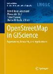
OpenStreetMap in GIScience: Experiences, Research, and Applications  1
收藏 引用
丛书名: lecture notes in geoinformation and cartography
2015年
作者: Jamal Jokar Arsanjani, Alexander Zipf, Peter Mooney, Marco Helbich (eds.)
This edited volume presents a collection of lessons learned with, and research conducted on, OpenStreetMap, the goal being to promote the projects integration. The respective chapters address a) state-of-the-art and c...
来源: 评论
A GIS-Based Process for Calculating Visibility Impact from Buildings During Transmission Line Routing  17
A GIS-Based Process for Calculating Visibility Impact from B...
收藏 引用
17th AGILE Conference on Geographic Information Science
作者: Grassi, Stefano Friedli, Roman Grangier, Michel Raubal, Martin ETH Inst Cartog & Geoinformat CH-8093 Zurich Switzerland Groupe e CH-1763 Granges Paccot Switzerland
Planning linear infrastructures can be a tedious task for regions characterized by complex topography, natural constraints, high density population areas, and strong local opposition. These aspects make the planning o... 详细信息
来源: 评论
Encoding and Querying Historic Map Content  17
Encoding and Querying Historic Map Content
收藏 引用
17th AGILE Conference on Geographic Information Science
作者: Scheider, Simon Jones, Jim Sanchez, Alber Kessler, Carsten Univ Munster Inst Geoinformat D-48149 Munster Germany City Univ New York CARSI Dept Geog Hunter Coll New York NY USA
Libraries have large collections of map documents with rich spatio-temporal information encoded in the visual representation of the map. Currently, historic map content is covered by the provided metadata only to a ve... 详细信息
来源: 评论
An Image Segmentation Process Enhancement for Land Cover Mapping from Very High Resolution Remote Sensing Data Application in a Rural Area  17
An Image Segmentation Process Enhancement for Land Cover Map...
收藏 引用
17th AGILE Conference on Geographic Information Science
作者: Vitter, M. Pluvinet, P. Vaudor, L. Jacqueminet, C. Martin, R. Etlicher, B. Univ St Etienne ISTHME UMR EVS 5600 6 Rue Basse Rives F-42023 St Etienne 02 France ASCONIT Consultants F-69366 Lyon 07 France ENS Lyon UMR EVS 5600 F-69342 Lyon 07 France
In this chapter, we describe a procedure for enhancing the automatic image segmentation for land cover mapping from Very High Resolution images. The increased need for large scale mapping (1: 10000) for local territor... 详细信息
来源: 评论
Event Identification from Georeferenced Images  17
Event Identification from Georeferenced Images
收藏 引用
17th AGILE Conference on Geographic Information Science
作者: Sun, Yeran Fan, Hongchao Heidelberg Univ Inst Geog GISci Res Grp Heidelberg Germany
Geotagged images (e.g., Flickr) could indicate some social events (e.g., festival, parade, protest, sports, etc.) with spatial, temporal and semantic information. Previous researches relied much on tag frequency, thus... 详细信息
来源: 评论
An Area Merge Operation for Smooth Zooming  17
An Area Merge Operation for Smooth Zooming
收藏 引用
17th AGILE Conference on Geographic Information Science
作者: Suba, Radan Meijers, Martijn Huang, Lina van Oosterom, Peter Delft Univ Technol OTB Res Built Environm Sect GIS Technol Delft Netherlands
When zooming a digital map it is often necessary that two or more area features must be merged. If this is done abruptly, it leads to big changes in geometry, perceived by the user as a "jump" on the screen.... 详细信息
来源: 评论
Line Matching for Integration of Photographic and Geographic Databases  17
Line Matching for Integration of Photographic and Geographic...
收藏 引用
17th AGILE Conference on Geographic Information Science
作者: Attia, Youssef Joliveau, Thierry Favier, Eric Univ St Etienne CNRS ISTHME EVS 6 Basse Rives St F-42023 St Etienne 02 France ENISE F-42023 Saint Etienne 02 France
The aim of this chapter is to describe a new method for assigning a geographical position to an urban picture. The method is based only on the content of the picture. The photograph is compared to a sample of geolocat... 详细信息
来源: 评论
Behaviour-Driven Development Applied to the Conformance Testing of INSPIRE Web Services  17
Behaviour-Driven Development Applied to the Conformance Test...
收藏 引用
17th AGILE Conference on Geographic Information Science
作者: Lopez-Pellicer, Francisco J. Angel Latre, Miguel Nogueras-Iso, Javier Javier Zarazaga-Soria, F. Barrera, Jesus Univ Zaragoza Zaragoza Spain GeoSLab SL Zaragoza Spain
The implementation of the INSPIRE directive requires to check the conformity of a large number of network services with the implementing rules of INSPIRE. The evaluation whether a service is fully conformant with INSP... 详细信息
来源: 评论
Exploring the Geographical Relations Between Social Media and Flood Phenomena to Improve Situational Awareness  17
Exploring the Geographical Relations Between Social Media an...
收藏 引用
17th AGILE Conference on Geographic Information Science
作者: Herfort, Benjamin de Albuquerque, Joao Porto Schelhorn, Svend-Jonas Zipf, Alexander Heidelberg Univ Chair GISci Heidelberg Germany
Recent research has shown that social media platforms like twitter can provide relevant information to improve situation awareness during emergencies. Previous work is mostly concentrated on the classification and ana... 详细信息
来源: 评论