Encoding the geographic coordinates into the compact string expression is an important problem in geosciences, therefore, several algorithms exist. Such a string is used for several purposes. One of the most frequent ...
详细信息
ISBN:
(纸本)9783319036113
Encoding the geographic coordinates into the compact string expression is an important problem in geosciences, therefore, several algorithms exist. Such a string is used for several purposes. One of the most frequent is probably its use as a part of a URL or as a hashtag of ad hoc data. An important part of spatially referenced data can be also a timestamp, but current encoding methods do not allow to encode the temporal dimension. In this chapter we propose a new encoding algorithm focused on a point data expressed by latitude, longitude and timestamp coordinates. The algorithm details are described and its use is shown on examples.
The automated recognition of transportmodes from GPS data is a problem that has received a lot of attention from academia and industry. There is a comprehensive body of literature discussing algorithms and methods to ...
详细信息
ISBN:
(纸本)9783319036113
The automated recognition of transportmodes from GPS data is a problem that has received a lot of attention from academia and industry. There is a comprehensive body of literature discussing algorithms and methods to find the right segments using mainly velocity-, acceleration-and accuracy-values. Less work is dedicated to the derivation of those variables. The goal of this chapter is to identify the most efficient way to preprocess GPS trajectory data for automated change-point (i.e., the points indicating a change in transportation mode) detection. Therefore the influence of different kernel based smoothing methods as well as an alternative velocity derivation method on the overall segmentation process is analyzed and assessed.
In many city comparisons and benchmarking attempts, scores are purely one-dimensional with results split accordingly for each dimension. We propose a methodology for comparing cities on multiple dimensions implemented...
详细信息
ISBN:
(纸本)9783319036113
In many city comparisons and benchmarking attempts, scores are purely one-dimensional with results split accordingly for each dimension. We propose a methodology for comparing cities on multiple dimensions implemented as a map-centric web tool based on a pairwise similarity measure. CityBench web tool provides a quick-scan geographical exploration of multidimensional similarity across European cities. With this dynamic method, the user may easily discover city peers that could face similar risks and opportunities and consequently develop knowledge networks and share best practices. This web tool is destined to provide economic/financing institutions', local governments' and policy makers' in Europe and beyond decision making support.
The chapter presents an approach for collecting and identifying the daily rounds of agronomists working in the field for a farming products company. Besides recognizing their daily movements, the approach enables the ...
详细信息
ISBN:
(纸本)9783319036113
The chapter presents an approach for collecting and identifying the daily rounds of agronomists working in the field for a farming products company. Besides recognizing their daily movements, the approach enables the collection of data about the shape and size of land parcels belonging to the company's clients. The work developed involved the design of spatial movement patterns for data collection through GPS logs, with minimal disruption of the agronomists' activities. The extracting of these patterns involved place and activity extraction, with specific algorithms proposed for marking and unmarking exploration parcels. These algorithms were evaluated by field testing with very positive results.
Interoperability is the main challenge on the way to efficiently find and access spatial data on the web. Significant contributions regarding interoperability have been made by the Open Geospatial Consortium (OGC), wh...
详细信息
ISBN:
(纸本)9783319036113
Interoperability is the main challenge on the way to efficiently find and access spatial data on the web. Significant contributions regarding interoperability have been made by the Open Geospatial Consortium (OGC), where web service standards to publish and download spatial data have been established. The OGCs GeoSPARQL specification targets spatial data on the Web as Linked Open Data (LOD) by providing a comprehensive vocabulary for annotation and querying. While OGC web service standards are widely implemented in Geographic Information Systems (GIS) and offer a seamless service infrastructure, the LOD approach offers structured techniques to interlink and semantically describe spatial information. It is currently not possible to use LOD as a data source for OGC web services. In this chapter we make a suggestion for technically linking OGC web services and LOD as a data source, and we explore and discuss its benefits. We describe and test an adapter that enables access to geographic LOD datasets from within OGC Web Feature Service (WFS), enabling most current GIS to access the Web of Data. We discuss performance tests by comparing the proposed adapter to a reference WFS implementation.
Wind is a dynamic geographic phenomenon that is often characterized by its speed and by the direction from which it blows. The cycle's effect of heating and cooling on the Earth's surface causes the wind speed...
详细信息
ISBN:
(纸本)9783319036113
Wind is a dynamic geographic phenomenon that is often characterized by its speed and by the direction from which it blows. The cycle's effect of heating and cooling on the Earth's surface causes the wind speed and direction to change throughout the day. Understanding the changeability of wind speed and direction simultaneously in long term time series of wind measurements is a challenging task. Discovering such pattern highlights the recurring of speed together with direction that can be extracted in specific chronological order of time. In this chapter, we present a novel way to explore wind speed and direction simultaneously using sequential pattern mining approach for detecting frequent patterns in spatio-temporal wind datasets. The Linear time Closed pattern Miner sequence (LCMseq) algorithm is constructed to search for significant sequential patterns of wind speed and direction simultaneously. Then, the extracted patterns were explored using visual representation called TileVis and 3D wind rose in order to reveal any valuable trends in the occurrences patterns. The applied methods demonstrated an improvement way of understanding of temporal characteristics of wind resources.
Buildings are man-made structures and serve several needs of society. Hence, they have a significant socio-economic relevance. From this point of view, building types should be strongly correlated to the shape and siz...
详细信息
ISBN:
(纸本)9783319036113
Buildings are man-made structures and serve several needs of society. Hence, they have a significant socio-economic relevance. From this point of view, building types should be strongly correlated to the shape and sized of their footprints on the one hand. On the other hand, building types are very impacted by the contextual configuration among building footprints. Based on this hypothesis, a novel approach is introduced to estimate building types of building footprints data on OpenStreetMap. The proposed approach has been tested for the building footprints data on OSM in Heidelberg, Germany. An overall accuracy of 85.77% can be achieved. Residential buildings can be labeled with accuracy of more than 90%. Besides, the proposed approach can distinguish industrial buildings and accessory buildings for storage with high accuracies. However, public buildings and commercial buildings are difficult to be estimated, since their footprints reveal a large diversity in shape and size.
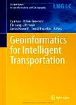
The aim of the book is to present and discuss new methods, issues and challenges involved in geoinformatics contribution to making transportation more intelligent, efficient and human-friendly. It covers a wide range ...
ISBN:
(数字)9783319114620
ISBN:
(纸本)9783319114620
The aim of the book is to present and discuss new methods, issues and challenges involved in geoinformatics contribution to making transportation more intelligent, efficient and human-friendly. It covers a wide range of topics related to transportation and geoinformatics. The themes are divided into four main sections: Transport modeling, Sensor data and services, Intelligent transport systems, and Transport planning and accessibility.
Current personal information management (PIM) tools do not sufficiently recognize the spatio-temporal, hierarchical, or conceptual relations of tasks that constitute our plans. Using behavioral observation methods we ...
详细信息
ISBN:
(纸本)9783319006154
Current personal information management (PIM) tools do not sufficiently recognize the spatio-temporal, hierarchical, or conceptual relations of tasks that constitute our plans. Using behavioral observation methods we analyzed people planning a trip to attend a conference taking place in a region they had little or no prior familiarity with. The resulting open-ended records were coded into higher-level segmentsand categories. These served as a basis for a cognitive engineering approach, to propose better design principles for spatio-temporally enabled PIM-tools.
The rapid development of crowd-sourcing or volunteered geographic information both challenges and provides opportunities to authoritative geospatial information. Matching geospatial ontologies is an essential element ...
详细信息
ISBN:
(纸本)9783319006154
The rapid development of crowd-sourcing or volunteered geographic information both challenges and provides opportunities to authoritative geospatial information. Matching geospatial ontologies is an essential element to realizing the synergistic use of disparate geospatial information. We propose a new semiautomatic method to match formal and informal real life geospatial ontologies, at both terminology level and instance level, ensuring that overall information is logically coherent and consistent. Disparate geospatial ontologies are matched by finding a consistent and coherent set of mapping axioms with respect to them. Disjointness axioms are generated in order to facilitate detection of errors. In contrast to other existing methods, disjointness axioms are seen as assumptions, which can be retracted during the overall process. We produce candidates for retraction automatically, but the ultimate decision is taken by domain experts. Geometry matching, lexical matching and cardinality checking are combined when matching geospatial individuals (spatial features).
暂无评论