咨询与建议

限定检索结果

文献类型

  • 936 篇 会议
  • 106 册 图书

馆藏范围

  • 1,040 篇 电子文献
  • 2 种 纸本馆藏

日期分布

学科分类号

  • 854 篇 工学
    • 686 篇 测绘科学与技术
    • 608 篇 计算机科学与技术...
    • 47 篇 信息与通信工程
    • 46 篇 环境科学与工程(可...
    • 27 篇 城乡规划学
    • 14 篇 水利工程
    • 5 篇 地质资源与地质工...
    • 3 篇 仪器科学与技术
    • 3 篇 建筑学
    • 1 篇 电子科学与技术(可...
    • 1 篇 控制科学与工程
  • 712 篇 理学
    • 539 篇 地理学
    • 172 篇 地球物理学
    • 23 篇 地质学
    • 1 篇 数学
    • 1 篇 大气科学
    • 1 篇 统计学(可授理学、...
  • 71 篇 历史学
    • 71 篇 世界史
  • 21 篇 医学
    • 21 篇 公共卫生与预防医...
  • 4 篇 管理学
    • 4 篇 公共管理

主题

  • 58 篇 geographical inf...
  • 49 篇 gis
  • 25 篇 earth sciences, ...
  • 25 篇 maps
  • 20 篇 ontology
  • 18 篇 lidar
  • 15 篇 citygml
  • 13 篇 mapping
  • 11 篇 geographic infor...
  • 10 篇 volunteered geog...
  • 10 篇 navigation
  • 10 篇 urban planning
  • 9 篇 semantics
  • 9 篇 linked data
  • 9 篇 disaster managem...
  • 8 篇 data integration
  • 8 篇 information syst...
  • 8 篇 computer applica...
  • 8 篇 spatial cognitio...
  • 8 篇 visualization

机构

  • 13 篇 univ munster ins...
  • 10 篇 ras st petersbur...
  • 7 篇 swiss fed inst t...
  • 6 篇 univ munster ins...
  • 6 篇 delft univ techn...
  • 6 篇 delft univ techn...
  • 5 篇 eotvos lorand un...
  • 5 篇 naval academy re...
  • 5 篇 russian acad sci...
  • 4 篇 tum tum sch engn...
  • 4 篇 wuhan univ sch r...
  • 4 篇 univ appl sci hm...
  • 4 篇 leibniz univ han...
  • 4 篇 vsb tech univ os...
  • 4 篇 inst social sci ...
  • 4 篇 palacky univ olo...
  • 4 篇 tech univ munich...
  • 4 篇 department of hi...
  • 4 篇 mit dept urban s...
  • 3 篇 finnish geospati...

作者

  • 9 篇 osaragi toshihir...
  • 9 篇 raubal martin
  • 8 篇 kuhn werner
  • 8 篇 zlatanova sisi
  • 8 篇 stoter jantien
  • 8 篇 van oosterom pet...
  • 7 篇 doellner juergen
  • 7 篇 frank andrew u.
  • 7 篇 haunert jan-henr...
  • 7 篇 manfred schrenk
  • 7 篇 schwering angela
  • 7 篇 kolbe thomas h.
  • 7 篇 kessler carsten
  • 7 篇 sisi zlatanova
  • 6 篇 scheider simon
  • 6 篇 timpf sabine
  • 6 篇 georg gartner
  • 6 篇 kray christian
  • 6 篇 jonietz david
  • 6 篇 levachkine sergu...

语言

  • 1,031 篇 英文
  • 11 篇 中文
检索条件"丛书名=Lecture Notes in Geoinformation and Cartography"
1042 条 记 录,以下是811-820 订阅
排序:
Immunocomputing for geoinformation Fusion and Forecast
Immunocomputing for Geoinformation Fusion and Forecast
收藏 引用
4th International Workshop on Information Fusion and Geographical Information Systems
作者: Tarakanov, Alexander RAS St Petersburg Inst Informat & Automat St Petersburg 199178 Russia
Based on immunocomputing (IC), this paper proposes a new way for geoinformation fusion, spatio-temporal modeling, and forecast. The approach includes mathematically, rigorous mapping of high-dimensional spatio-tempora... 详细信息
来源: 评论
Applying Instance Visualisation and Conceptual Schema Mapping for Geodata Harmonisation  1
收藏 引用
12th Association-of-Geographic-Information-Laboratories-for-Europe (AGILE) Conference/Workshop of the International-Society-of-Photogrammetry-and-Remote-Sensing (ISPRS)
作者: Reitz, Thorsten Kuijper, Arjan Fraunhofer Inst Comp Graph Res IGD D-64283 Darmstadt Germany
This paper gives an introduction to concepts for a better expert knowledge extraction for geodata harmonisation. Geodata harmonisation involves overcoming heterogeneities on the syntactic, schematic and se-mantic leve... 详细信息
来源: 评论
Line Decomposition Based on Critical Points Detection  1
收藏 引用
12th Association-of-Geographic-Information-Laboratories-for-Europe (AGILE) Conference/Workshop of the International-Society-of-Photogrammetry-and-Remote-Sensing (ISPRS)
作者: Guilbert, Eric Hong Kong Polytech Univ Dept Land Surveying & GeoInformat Kowloon Hong Kong Peoples R China
The problem of line simplification is a recurrent problem in cartography. The purpose is to remove irrelevant details while emphasising the main features of the line. Most of the current techniques belong to the spati... 详细信息
来源: 评论
Estimating Spatio-Temporal Distribution of Railroad Users and Its Application to Disaster Prevention Planning  1
收藏 引用
12th Association-of-Geographic-Information-Laboratories-for-Europe (AGILE) Conference/Workshop of the International-Society-of-Photogrammetry-and-Remote-Sensing (ISPRS)
作者: Osaragi, Toshihiro Tokyo Inst Technol Dept Mech & Environm Informat Grad Sch Informat Sci & Engn Meguro Ku Tokyo 1528552 Japan
To develop measures for minimizing human damage from a devastating earthquake, it is important to understand the characteristics of the population and its spatio-temporal distribution in an urban area. In the present ... 详细信息
来源: 评论
Enhancing 3D City Models with Heterogeneous Spatial Information: Towards 3D Land Information Systems  1
收藏 引用
12th Association-of-Geographic-Information-Laboratories-for-Europe (AGILE) Conference/Workshop of the International-Society-of-Photogrammetry-and-Remote-Sensing (ISPRS)
作者: Ross, Lutz Bolling, Jannes Doellner, Juergen Kleinschmit, Birgit Berlin Inst Technol Dept Landscape Architecture & Environm Planning Str 17 Juni 145 D-10623 Berlin Germany Berlin Inst Technol Dept Geodesy & Geoinformat Sci D-10623 Berlin Germany Hasso Plattner Inst Software Syst Engn Potsdam 14482 Germany
Spatial and georeferenced information plays an important role in urban land management processes such as spatial planning and environmental management. As many of the processes are increasingly coined by participation... 详细信息
来源: 评论
Automatic Revision of 2D Building Databases from High Resolution Satellite Imagery: A 3D Photogrammetric Approach  1
收藏 引用
12th Association-of-Geographic-Information-Laboratories-for-Europe (AGILE) Conference/Workshop of the International-Society-of-Photogrammetry-and-Remote-Sensing (ISPRS)
作者: Champion, Nicolas Stamon, Georges Pierrot-Deseilligny, Marc MATIS Inst Geog Natl 2-4 Ave Pasteur F-94160 St Mande France Univ Paris Descartes CRIP5 SIP F-75006 Paris France
Among all the issues involved in Geographic Information Science, automating the update of 2D building databases is a crucial and challenging issue. Such an update usually starts out with a manual change detection proc... 详细信息
来源: 评论
Design of Entrusting Protocols for Software Protection
收藏 引用
4th International Workshop on Information Fusion and Geographical Information Systems
作者: Desnitsky, Vasily Kotenko, Igor RAS St Petersburg Inst Informat & Automat St Petersburg 199178 Russia
The paper considers the problem of design and analysis of entrusting protocols used within software protection mechanisms, including the protection mechanisms for Geographical Information Systems (GIS). The main goal ... 详细信息
来源: 评论
Integrated Usage of Data Mining Methods for Malware Detection
Integrated Usage of Data Mining Methods for Malware Detectio...
收藏 引用
4th International Workshop on Information Fusion and Geographical Information Systems
作者: Komashinskiy, Dmitriy Kotenko, Igor St Petersburg Inst Informat & Automat SPIIRAS St Petersburg Russia
The problem of counteracting malicious software (malware) remains a real one in all computer systems, including Geographical Information Systems (GIS), despite the obvious successes of antivirus vendors in technologie... 详细信息
来源: 评论
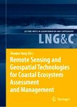
Remote Sensing and Geospatial Technologies for Coastal Ecosystem Assessment and Management  2009
收藏 引用
丛书名: lecture notes in geoinformation and cartography
2009年
作者: Xiaojun Yang
来源: 评论
Geographical Information System for Analysis of Critical Infrastructures and their Hazards due to Terrorism, Man-Originated Catastrophes and Natural Disasters for the City of Gdansk
Geographical Information System for Analysis of Critical Inf...
收藏 引用
4th International Workshop on Information Fusion and Geographical Information Systems
作者: Kulawiak, Marcin Lubniewski, Zbigniew Bikonis, Krzysztof Stepnowski, Andrzej Gdansk Univ Technol Dept Geoinformat PL-80953 Gdansk Poland
The paper presents a web-based Geographic Information System (GIS) for assessment and visualization of Critical Infrastructure (CI) and its hazards which was developed by the Department of Geoinformatics at Gdansk Uni... 详细信息
来源: 评论