咨询与建议

限定检索结果

文献类型

  • 49 篇 会议
  • 37 篇 期刊文献
  • 4 册 图书
  • 2 篇 学位论文

馆藏范围

  • 92 篇 电子文献
  • 0 种 纸本馆藏

日期分布

学科分类号

  • 72 篇 工学
    • 30 篇 测绘科学与技术
    • 26 篇 计算机科学与技术...
    • 20 篇 环境科学与工程(可...
    • 19 篇 软件工程
    • 16 篇 电气工程
    • 14 篇 仪器科学与技术
    • 13 篇 光学工程
    • 13 篇 控制科学与工程
    • 8 篇 航空宇航科学与技...
    • 6 篇 建筑学
    • 5 篇 信息与通信工程
    • 4 篇 机械工程
    • 4 篇 土木工程
    • 4 篇 地质资源与地质工...
    • 3 篇 生物工程
    • 2 篇 水利工程
  • 41 篇 理学
    • 17 篇 物理学
    • 10 篇 地理学
    • 9 篇 地球物理学
    • 6 篇 数学
    • 6 篇 生物学
    • 4 篇 大气科学
    • 3 篇 化学
    • 3 篇 地质学
    • 2 篇 海洋科学
    • 2 篇 生态学
    • 2 篇 统计学(可授理学、...
  • 18 篇 医学
    • 18 篇 临床医学
  • 12 篇 农学
    • 10 篇 农业资源与环境
  • 6 篇 管理学
    • 4 篇 管理科学与工程(可...
  • 1 篇 经济学
  • 1 篇 法学

主题

  • 28 篇 remote sensing
  • 15 篇 image processing
  • 8 篇 deep learning
  • 5 篇 computer vision
  • 3 篇 object detection
  • 3 篇 image segmentati...
  • 3 篇 mathematical mor...
  • 2 篇 parallel process...
  • 2 篇 uas
  • 2 篇 drones
  • 2 篇 sar
  • 2 篇 fires
  • 2 篇 hyperspectral se...
  • 2 篇 lidar
  • 2 篇 uav
  • 2 篇 feature extracti...
  • 2 篇 synthetic apertu...
  • 2 篇 machine learning
  • 2 篇 land use
  • 2 篇 image classifica...

机构

  • 2 篇 中国科学院遥感应...
  • 2 篇 land and resourc...
  • 2 篇 the hong kong po...
  • 2 篇 school of urban ...
  • 2 篇 school of geodes...
  • 2 篇 school of resour...
  • 2 篇 state key labora...
  • 2 篇 collaborative in...
  • 1 篇 oklahoma state u...
  • 1 篇 univ nice cassio...
  • 1 篇 univ twente fac ...
  • 1 篇 environmental re...
  • 1 篇 chinese acad sci...
  • 1 篇 department of el...
  • 1 篇 beijing inst tec...
  • 1 篇 defence research...
  • 1 篇 spectral science...
  • 1 篇 king saud univ c...
  • 1 篇 univ maryland no...
  • 1 篇 ohio state univ ...

作者

  • 2 篇 qihao weng
  • 1 篇 sun jiande
  • 1 篇 lukin vladimir
  • 1 篇 ramos lucia
  • 1 篇 mondejar-guerra ...
  • 1 篇 thyagharajan k. ...
  • 1 篇 croft holly
  • 1 篇 ioannidis ch
  • 1 篇 gilbert marius
  • 1 篇 reyes abel a.
  • 1 篇 burnaev evgeny
  • 1 篇 potapov georgy
  • 1 篇 su cheng
  • 1 篇 kaul ajay
  • 1 篇 soile s.
  • 1 篇 idayachandran g.
  • 1 篇 peng bo
  • 1 篇 jorgenson mark t...
  • 1 篇 akın kısa
  • 1 篇 essa almabrok

语言

  • 82 篇 英文
  • 6 篇 中文
  • 4 篇 其他
检索条件"任意字段=Colloquium on Recent Developments in Image Processing: Applications in Remote Sensing"
92 条 记 录,以下是31-40 订阅
排序:
Real-time and post-processed georeferencing for hyperpspectral drone remote sensing
Real-time and post-processed georeferencing for hyperpspectr...
收藏 引用
2018 ISPRS TC II Mid-term Symposium "Towards Photogrammetry 2020"
作者: Oliveira, R.A. Khoramshahi, E. Suomalainen, J. Hakala, T. Viljanen, N. Honkavaara, E. Finnish Geospatial Research Institute FGI Finland University of Helsinki Department of Computer Science Finland
The use of drones and photogrammetric technologies are increasing rapidly in different applications. Currently, drone processing workflow is in most cases based on sequential image acquisition and post-processing, but... 详细信息
来源: 评论
Impact of Deep Learning in image processing and Computer Vision
Impact of Deep Learning in Image Processing and Computer Vis...
收藏 引用
International Conference on Microelectronics, Electromagnetics and Telecommunications, ICMEET 2017
作者: Goswami, Tilottama Department of Computer Science and Engineering BVRIT Hyderabad College of Engineering for Women Telangana500 090 India
With deep learning techniques, a revolution has taken place in the field of image processing and computer vision. The survey paper emphasizes the importance of representation learning methods for machine learning task... 详细信息
来源: 评论
The application of Chinese high-spatial-resolution remote sensing satellite image in land law enforcement information extraction
The application of Chinese high-spatial-resolution remote se...
收藏 引用
2018 ISPRS TC III Mid-Term Symposium on developments, Technologies and applications in remote sensing
作者: Wang, Ningna Yang, Rujun Land and Resources Information Center of Guangxi Zhuang Autonomous Region Nanning China
Chinese high - resolution (HR) remote sensing satellites have made huge leap in the past decade. Commercial satellite datasets, such as GF-1, GF-2 and ZY-3 images, the panchromatic images (PAN) resolution of them are ... 详细信息
来源: 评论
CLOUD DETECTION by FUSING MULTI-SCALE CONVOLUTIONAL FEATURES
收藏 引用
2018 ISPRS TC III Mid-Term Symposium on developments, Technologies and applications in remote sensing
作者: Li, Zhiwei Shen, Huanfeng Wei, Yancong Cheng, Qing Yuan, Qiangqiang School of Resource and Environmental Sciences Wuhan University Wuhan China State Key Laboratory of Information Engineering in Surveying Mapping and Remote Sensing Wuhan University Wuhan China School of Urban Design of Wuhan University Wuhan University Wuhan China School of Geodesy and Geomatics Wuhan University Wuhan China Collaborative Innovation Center of Geospatial Technology Wuhan China
Clouds detection is an important pre-processing step for accurate application of optical satellite imagery. recent studies indicate that deep learning achieves best performance in image segmentation tasks. Aiming at b... 详细信息
来源: 评论
DESIGN AND VERIFICATION OF remote sensing image DATA CENTER STORAGE ARCHITECTURE BASED ON HADOOP
DESIGN AND VERIFICATION OF REMOTE SENSING IMAGE DATA CENTER ...
收藏 引用
The ISPRS Technical Commission III Midterm Symposium on "developments, Technologies and applications in remote sensing"
作者: Dejin Tang Xiaoming Zhou Yang Jing Wang Cong Caiping Li National Geomatics Center of China Beijing Institute of Remote Sensing Information
The data center is a new concept of data processing and application proposed in recent years. It is a new method of processing technologies based on data, parallel computing, and compatibility with different hardware ... 详细信息
来源: 评论
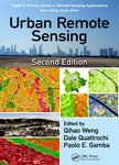
Urban remote sensing  Second edition.
收藏 引用
丛书名: remote sensing applications Series
2018年
作者: Qihao Weng Dale A Quattrochi Paolo E Gamba
Urban remote sensing, Second Edition assembles a team of professional experts to provide a much-needed update on the applications of remote sensing technology to urban and suburban areas. This book reflects new develo... 详细信息
来源: 评论
How do you find the green sheep? A critical review of the use of remotely sensed imagery to detect and count animals
收藏 引用
METHODS IN ECOLOGY AND EVOLUTION 2018年 第4期9卷 881-892页
作者: Hollings, Tracey Burgman, Mark van Andel, Mary Gilbert, Marius Robinson, Timothy Robinson, Andrew Univ Melbourne Sch Biosci Ctr Excellence Biosecur Risk Anal Melbourne Vic Australia Imperial Coll London Ctr Environm Policy London England Minist Primary Ind Wellington New Zealand Univ Libre Bruxelles Spatial Epidemiol Lab Brussels Belgium Fonds Natl Rech Sci Brussels Belgium Food & Agr Org United Nations Rome Italy
1. Animal abundance data are essential for endangered species conservation, tracking invasive species spread, biosecurity, agricultural applications and wildlife monitoring;however, obtaining abundance data are a pere... 详细信息
来源: 评论
Targeted change detection in remote sensing images
arXiv
收藏 引用
arXiv 2018年
作者: Ignatiev, Vladimir Trekin, Alexey Lobachev, Viktor Potapov, Georgy Burnaev, Evgeny Skolkovo institute of Science and technology Nobel st. 1 Moscow Russia
recent developments in the remote sensing systems and image processing made it possible to propose a new method of the object classification and detection of the specific changes in the series of satellite Earth image... 详细信息
来源: 评论
INFLUENCE OF SKY CONDITIONS ON ESTIMATION OF PHOTOSYNTHETIC PHOTON FLUX DENSITY FOR AGRICULTURAL ECOSYSTEM
INFLUENCE OF SKY CONDITIONS ON ESTIMATION OF PHOTOSYNTHETIC ...
收藏 引用
The ISPRS Technical Commission III Midterm Symposium on "developments, Technologies and applications in remote sensing"
作者: M.Yamashita M.Yoshimura Tokyo University of Agriculture and Technology Faculty of Agriculture
Photosynthetic photon flux density(PPFD: mmol m s) is indispensable for plant physiology processes in photosynthesis. However, PPFD is seldom measured, so that PPFD has been estimated by using solar radiation(SR: W m)... 详细信息
来源: 评论
WATER MAPPING USING MULTISPECTRAL AIRBORNE LIDAR DATA
收藏 引用
The ISPRS Technical Commission III Midterm Symposium on "developments, Technologies and applications in remote sensing"
作者: WaiYeung Yan Ahmed Shaker Paul E.La Rocque Department of Civil Engineering Ryerson University
This study investigates the use of the world's first multispectral airborne Li DAR sensor, Optech Titan, manufactured by Teledyne Optech to serve the purpose of automatic land-water classification with a particula... 详细信息
来源: 评论