咨询与建议

限定检索结果

文献类型

  • 399 篇 期刊文献
  • 86 篇 会议
  • 10 篇 学位论文

馆藏范围

  • 495 篇 电子文献
  • 0 种 纸本馆藏

日期分布

学科分类号

  • 428 篇 工学
    • 301 篇 测绘科学与技术
    • 214 篇 环境科学与工程(可...
    • 41 篇 电气工程
    • 36 篇 计算机科学与技术...
    • 26 篇 水利工程
    • 21 篇 光学工程
    • 16 篇 仪器科学与技术
    • 10 篇 控制科学与工程
    • 9 篇 地质资源与地质工...
    • 7 篇 城乡规划学
    • 6 篇 林业工程
    • 6 篇 风景园林学(可授工...
    • 5 篇 航空宇航科学与技...
  • 368 篇 理学
    • 234 篇 地球物理学
    • 85 篇 地理学
    • 39 篇 物理学
    • 39 篇 生物学
    • 31 篇 生态学
    • 18 篇 大气科学
    • 13 篇 地质学
    • 8 篇 海洋科学
    • 7 篇 化学
    • 6 篇 天文学
  • 212 篇 医学
    • 210 篇 临床医学
  • 56 篇 农学
    • 15 篇 农业资源与环境
    • 11 篇 林学
    • 8 篇 作物学
    • 6 篇 园艺学
  • 26 篇 管理学
    • 24 篇 管理科学与工程(可...
  • 6 篇 法学
    • 6 篇 社会学
  • 4 篇 历史学
  • 2 篇 艺术学

主题

  • 495 篇 object-based ima...
  • 68 篇 remote sensing
  • 31 篇 machine learning
  • 28 篇 random forest
  • 23 篇 segmentation
  • 23 篇 image segmentati...
  • 20 篇 change detection
  • 18 篇 support vector m...
  • 18 篇 lidar
  • 16 篇 classification
  • 15 篇 worldview-2
  • 13 篇 image classifica...
  • 13 篇 land cover
  • 12 篇 land cover class...
  • 12 篇 uav
  • 12 篇 unmanned aerial ...
  • 12 篇 obia
  • 9 篇 geobia
  • 9 篇 google earth eng...
  • 9 篇 landsat

机构

  • 10 篇 univ chinese aca...
  • 7 篇 jiangsu ctr coll...
  • 5 篇 univ salzburg de...
  • 5 篇 nanjing normal u...
  • 4 篇 nanjing normal u...
  • 4 篇 peking univ inst...
  • 4 篇 nanjing normal u...
  • 4 篇 univ twente fac ...
  • 4 篇 florida atlantic...
  • 3 篇 brigham young un...
  • 3 篇 china univ min &...
  • 3 篇 univ washington ...
  • 3 篇 chinese acad sci...
  • 3 篇 univ tabriz dept...
  • 3 篇 univ salzburg de...
  • 2 篇 univ calif berke...
  • 2 篇 inner mongolia a...
  • 2 篇 beijing normal u...
  • 2 篇 goddard earth sc...
  • 2 篇 univ utrecht dep...

作者

  • 7 篇 blaschke thomas
  • 7 篇 wang min
  • 6 篇 zhou weiqi
  • 5 篇 janowski lukasz
  • 5 篇 salehi bahram
  • 4 篇 taubenboeck hann...
  • 4 篇 lakes tobia
  • 4 篇 wang jie
  • 4 篇 johansen kasper
  • 4 篇 pu ruiliang
  • 4 篇 geiss christian
  • 4 篇 zhang xiuyuan
  • 3 篇 zhang tao
  • 3 篇 moskal l. monika
  • 3 篇 wieland marc
  • 3 篇 vijay ritesh
  • 3 篇 ma lei
  • 3 篇 gong peng
  • 3 篇 chen gang
  • 3 篇 ming dongping

语言

  • 442 篇 英文
  • 52 篇 其他
  • 1 篇 中文
检索条件"主题词=Object-based Image Analysis"
495 条 记 录,以下是431-440 订阅
排序:
Estimating Class Dynamics for Fuzzy Markov Chain-based Multitemporal Cascade Classification
收藏 引用
IEEE GEOSCIENCE AND REMOTE SENSING LETTERS 2013年 第4期10卷 908-912页
作者: Feitosa, Raul Q. Mota, Guilherme L. A. Alves, Andrei O. Costa, Gilson A. O. P. Pontificia Univ Catolica Rio de Janeiro Dept Elect Engn BR-22451900 Rio De Janeiro Brazil Univ Estado Rio De Janeiro Dept Comp Syst Engn BR-20550900 Rio De Janeiro Brazil Univ Estado Rio De Janeiro Inst Math & Stat BR-20550900 Rio De Janeiro Brazil Univ Estado Rio De Janeiro BR-20550900 Rio De Janeiro Brazil
The key component of a fuzzy Markov chain (FMC)-based multitemporal cascade classifier is the transition possibility matrix (TPM). Such matrix represents the temporal dynamics of the land use/land cover classes in the... 详细信息
来源: 评论
object-based mapping of native vegetation and para grass (Urochloa mutica) on a monsoonal wetland of Kakadu NP using a Landsat 5 TM Dry-season time series
收藏 引用
JOURNAL OF SPATIAL SCIENCE 2013年 第1期58卷 53-77页
作者: Boyden, James Joyce, Karen E. Boggs, Guy Wurm, Penny Charles Darwin Univ Sch Environm & Life Sci Res Inst Environm & Livelihoods Darwin NT 0909 Australia Wheatbelt Nat Resource Management Northam WA 6401 Australia
This paper evaluates the use of multi-temporal Landsat 5 TM for object-based classification of native wetland vegetation and the perennial aquatic weed para grass within Kakadu National Park, Northern Territory, Austr... 详细信息
来源: 评论
Identifying permafrost slope disturbance using multi-temporal optical satellite images and change detection techniques
收藏 引用
COLD REGIONS SCIENCE AND TECHNOLOGY 2013年 88卷 37-49页
作者: Rudy, Ashley C. A. Lamoureux, Scott F. Treitz, Paul Collingwood, Adam Queens Univ Dept Geog Kingston ON K7L 3N6 Canada
Active layer detachments (ALDs) are a common form of permafrost slope disturbance that pose a serious risk for infrastructure and can impact environmental and ecological stability in Arctic regions. Effective recognit... 详细信息
来源: 评论
Modelling habitat suitability for alpine rock ptarmigan (Lagopus muta helvetica) combining object-based classification of IKONOS imagery and Habitat Suitability Index modelling
收藏 引用
ECOLOGICAL MODELLING 2013年 254卷 22-32页
作者: Zohmann, Margit Pennerstorfer, Josef Nopp-Mayr, Ursula Univ Nat Resources & Life Sci Dept Integrat Biol & Biodivers Res Inst Wildlife Biol & Game Management A-1180 Vienna Austria Univ Nat Resources & Life Sci Dept Forest & Soil Sci Inst Forest Entomol Forest Pathol & Forest Protec A-1190 Vienna Austria
The maintenance and restoration of high-quality habitats of wildlife species in alpine ecosystems are key issues in conservation biology. The rock ptarmigan (Lagopus muta helvetica), which prefers open habitats above ... 详细信息
来源: 评论
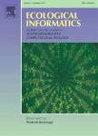
Remote sensing image data and automated analysis to describe marine bird distributions and abundances
收藏 引用
ECOLOGICAL INFORMATICS 2013年 14卷 2-8页
作者: Groom, Geoff Stjernholm, Michael Nielsen, Rasmus Due Fleetwood, Andrew Petersen, Ib Krag Aarhus Univ Dept Biosci DK-8410 Ronde Denmark Blom UK Astrolabe Cheddar BS27 3EB Somerset England
Advances in image data capture with airborne digital cameras and in object-based image analysis (OBIA) have provided a basis for new arenas of applied remote sensing, one of which is the direct counting and mapping of... 详细信息
来源: 评论
Mapping the distribution of the main host for plague in a complex landscape in Kazakhstan: An object-based approach using SPOT-5 XS, Landsat 7 ETM+, SRTM and multiple Random Forests
收藏 引用
INTERNATIONAL JOURNAL OF APPLIED EARTH OBSERVATION AND GEOINFORMATION 2013年 第100期23卷 81-94页
作者: Wilschut, L. I. Addink, E. A. Heesterbeek, J. A. P. Dubyanskiy, V. M. Davis, S. A. Laudisoit, A. Begon, M. Burdelov, L. A. Atshabar, B. B. de Jong, S. M. Univ Utrecht Dept Phys Geog NL-3508 TC Utrecht Netherlands Univ Utrecht Fac Vet Med NL-3584 CL Utrecht Netherlands Stavropol Plague Control Res Inst Stavropol 355035 Russia M Aikimbayevs Kazakh Sci Ctr Quarantine & Zoonot Antiplague Inst Alma Ata 050074 Kazakhstan RMIT Univ Sch Math & Geospatial Sci Melbourne Vic 3000 Australia Univ Liverpool Inst Integrat Biol Liverpool L69 3BX Merseyside England Univ Antwerp Dept Biol B-2020 Antwerp Belgium
Plague is a zoonotic infectious disease present in great gerbil populations in Kazakhstan. Infectious disease dynamics are influenced by the spatial distribution of the carriers (hosts) of the disease. The great gerbi... 详细信息
来源: 评论
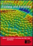
Landscape resource mapping for wildlife research using very high resolution satellite imagery
收藏 引用
METHODS IN ECOLOGY AND EVOLUTION 2013年 第10期4卷 982-992页
作者: Recio, Mariano R. Mathieu, Renaud Hall, G. Brent Moore, Antoni B. Seddon, Philip J. Univ Otago Sch Surveying Dunedin New Zealand Univ Otago Dept Zool Dunedin New Zealand CSIR Nat Resource Environm Earth Observat Res Grp Pretoria South Africa
Quantifying wildlife-habitat relationships through resource selection analysis (RSA) has traditionally relied on landscape variables extracted at medium-to-coarse scales and general-purpose digital maps. However, RSA ... 详细信息
来源: 评论
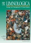
Optical remote sensing of submerged aquatic vegetation: Opportunities for shallow clearwater streams
收藏 引用
LIMNOLOGICA 2013年 第5期43卷 388-398页
作者: Visser, Fleur Wallis, Caroline Sinnott, Anne M. Univ Worcester Inst Sci & Environm Henwick Grove WR2 6AJ Worcester England
Remote sensing has rarely been used as a tool to map and monitor submerged aquatic vegetation (SAV) in rivers, due to a combination of insufficient spatial resolution of available image data and strong attenuation of ... 详细信息
来源: 评论
Integrating field survey and orthophoto information to monitor coastal habitats - A pilot study to develop methods and resolve key issues
收藏 引用
ECOLOGICAL INFORMATICS 2013年 14卷 48-52页
作者: Juel, Anders Ejrnaes, Rasmus Fredshavn, Jesper Groom, Geoff Aarhus Univ Dept Biosci DK-8410 Kaloe Roende Denmark Aarhus Univ Natl Ctr Environm & Energy DK-8600 Silkeborg Denmark
Implementation of mapping and monitoring is necessary to supply sufficient information to guide an effective management of species, habitats and landscapes. Coastal ecosystems can be difficult to monitor effectively i... 详细信息
来源: 评论
DEM-based Slope Unit Derivation
收藏 引用
21st International Conference on Geoinformatics (Geoinformatics)
作者: Xiao, Chenchao Tian, Yuan Li, Ting Gao, Zhifang Peking Univ Inst Remote Sensing & Geog Informat Syst Beijing 100871 Peoples R China China Aero Geophys Survey & Remote Sensing Ctr La Beijing Peoples R China
This paper focuses on slope unit derivation from DEM by object-based image analysis. A landform classification system consisting of ridge, valley, slope unit, and flat terrain classes is firstly constructed considerin... 详细信息
来源: 评论