咨询与建议

限定检索结果

文献类型

  • 2,167 篇 会议
  • 1,954 篇 期刊文献
  • 1 册 图书

馆藏范围

  • 4,122 篇 电子文献
  • 0 种 纸本馆藏

日期分布

学科分类号

  • 2,431 篇 工学
    • 850 篇 计算机科学与技术...
    • 686 篇 软件工程
    • 529 篇 信息与通信工程
    • 442 篇 环境科学与工程(可...
    • 371 篇 仪器科学与技术
    • 315 篇 控制科学与工程
    • 313 篇 光学工程
    • 289 篇 土木工程
    • 276 篇 测绘科学与技术
    • 273 篇 电子科学与技术(可...
    • 257 篇 航空宇航科学与技...
    • 248 篇 建筑学
    • 216 篇 电气工程
    • 198 篇 水利工程
    • 192 篇 化学工程与技术
    • 182 篇 机械工程
    • 166 篇 农业工程
    • 159 篇 城乡规划学
  • 1,859 篇 理学
    • 576 篇 数学
    • 493 篇 大气科学
    • 447 篇 物理学
    • 302 篇 地球物理学
    • 239 篇 统计学(可授理学、...
    • 235 篇 地质学
    • 216 篇 生物学
    • 203 篇 化学
  • 482 篇 管理学
    • 242 篇 图书情报与档案管...
    • 240 篇 管理科学与工程(可...
  • 451 篇 农学
    • 217 篇 农业资源与环境
    • 205 篇 作物学
  • 72 篇 医学
  • 71 篇 法学
  • 63 篇 经济学
  • 23 篇 文学
  • 12 篇 艺术学
  • 11 篇 军事学
  • 5 篇 教育学

主题

  • 447 篇 remote sensing
  • 149 篇 satellites
  • 120 篇 synthetic apertu...
  • 77 篇 feature extracti...
  • 74 篇 vegetation mappi...
  • 63 篇 accuracy
  • 61 篇 hyperspectral im...
  • 60 篇 image segmentati...
  • 60 篇 monitoring
  • 60 篇 soil moisture
  • 58 篇 modis
  • 56 篇 earth
  • 52 篇 reflectivity
  • 51 篇 land surface tem...
  • 50 篇 land surface
  • 49 篇 spatial resoluti...
  • 49 篇 training
  • 48 篇 deep learning
  • 48 篇 data mining
  • 46 篇 vegetation

机构

  • 149 篇 state key labora...
  • 114 篇 school of remote...
  • 79 篇 university of ch...
  • 66 篇 beijing institut...
  • 66 篇 school of remote...
  • 60 篇 school of remote...
  • 52 篇 state key labora...
  • 37 篇 institute of rem...
  • 36 篇 state key labora...
  • 32 篇 key laboratory o...
  • 29 篇 aerospace inform...
  • 28 篇 remote sensing t...
  • 27 篇 college of resou...
  • 27 篇 school of inform...
  • 24 篇 jiangsu provinci...
  • 23 篇 institute of rem...
  • 23 篇 state key labora...
  • 23 篇 geomatics colleg...
  • 23 篇 institute of rem...
  • 23 篇 school of resour...

作者

  • 19 篇 zhu xiao xiang
  • 18 篇 guoqing zhou
  • 17 篇 zezhong zheng
  • 17 篇 qinhuo liu
  • 16 篇 shuanggen jin
  • 16 篇 xiao xiang zhu
  • 15 篇 massimo menenti
  • 14 篇 wei li
  • 14 篇 ketut wikantika
  • 13 篇 shao zhenfeng
  • 13 篇 jiang tao
  • 13 篇 zhang liangpei
  • 12 篇 yilei shi
  • 12 篇 xiaofeng yang
  • 12 篇 wang li
  • 11 篇 josaphat tetuko ...
  • 11 篇 tao jiang
  • 11 篇 schott john r.
  • 11 篇 husi letu
  • 11 篇 peijun du

语言

  • 3,785 篇 英文
  • 221 篇 其他
  • 106 篇 中文
  • 4 篇 法文
  • 3 篇 德文
检索条件"机构=Science Program in Remote Sensing Science and Technology"
4122 条 记 录,以下是491-500 订阅
排序:
Research on the Application of the Radiative Transfer Model Based on Deep Neural Network in One-dimensional Variational Algorithm
收藏 引用
Journal of Tropical Meteorology 2022年 第3期28卷 326-342页
作者: HE Qiu-rui ZHANG Rui-ling LI Jiao-yang WANG Zhen-zhan School of Information Technology Luoyang Normal UniversityLuoyangHenan 471934 China Key Laboratory of Microwave Remote Sensing National Space Science CenterChinese Academy of SciencesBeijing 100190 China Department of Electrical and Computer Engineering Michigan State UniversityEast LansingMI 48824 USA
As a typical physical retrieval algorithm for retrieving atmospheric parameters,one-dimensional variational(1 DVAR)algorithm is widely used in various climate and meteorological communities and enjoys an important pos... 详细信息
来源: 评论
Multi-objective Pedestrian Tracking Based on Attention Multi-Scale Feature Fusion with Dynamic Sample
Multi-objective Pedestrian Tracking Based on Attention Multi...
收藏 引用
Electronic Communication and Artificial Intelligence (IWECAI), International Workshop on
作者: Yulong Zhang Huafeng Chen School of Information Engineering Huzhou University Huzhou China School of Information Science and Technology Zhejiang Shuren University Hangzhou China Remote Sensing Image Processing and Application International Science and Technology Cooperation Base of Zhejiang Province mHangzhou China
We proposed a detection framework that utilizes dynamic upsampling operators inattention-scale sequence fusion and applied to multi-object pedestrian tracking tasks. For small objects, we employed the Channel and Spat... 详细信息
来源: 评论
Vector transformation and reduction to the pole for regional magnetic data with variable field direction
收藏 引用
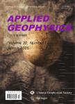
Applied Geophysics 2022年 第1期19卷 107-116,145,146页
作者: Luo Yao Wu Mei-Ping China Aero Geophysical Survey and Remote Sensing Center for Natural and Resources Beijing 100083China College of Intelligence Science and Technology National University of Defense TechnologyChangsha 410073China.
The vector transformation and pole reduction from the total-field anomaly are signifi cant for the *** examined these industry-standard processing procedures in the Fourier *** propose a novel iteration algorithm for ... 详细信息
来源: 评论
Evapotranspiration estimation using SEBAL algorithm integrated with remote sensing and experimental methods
收藏 引用
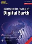
International Journal of Digital Earth 2021年 第11期14卷 1638-1658页
作者: Nazila Shamloo Mohammad Taghi Sattari Halit Apaydin Khalil Valizadeh Kamran Ramendra Prasad Department of Water Engineering Agriculture FacultyUniversity of TabrizTabriz ***Iran Department of Agricultural Engineering Faculty of AgricultureAnkara UniversityAnkara 06110 Turkey Department of Remote Sensing and GIS University of TabrizTabriz ***Iran Department of Science School of Science and TechnologyThe University of FijiFiji
Evapotranspiration is one of the most important elements of the hydrological *** of evapotranspiration is imperative for effective forest,irrigation,rangeland and water resources management as well as to increase yiel... 详细信息
来源: 评论
Ship Detection in SAR Images Using Attentive YOLOv8 Architecture
Ship Detection in SAR Images Using Attentive YOLOv8 Architec...
收藏 引用
remote sensing Symposium (InGARSS), 2020 IEEE India Geoscience and
作者: Sushma R Iliger Damodar Reddy Edla Subrat Kumar Acharya P Manjusree GOA Department of Computer Science and Engineering National Institute of Technology GOA GOA INDIA National Remote Sensing Centre ISRO Advanced Analytics Division HYDERABAD INDIA
Use of remote sensing technology in recent years has seen a rapid growth especially by government organisations to identify objects in marine ecosystems in remote sensed images. Ship detection is one such task that ha... 详细信息
来源: 评论
On the effects of spatial resolution on effective distance measurement in digital landscapes
收藏 引用
Ecological Processes 2021年 第1期10卷 659-677页
作者: Rachel Mundeli Murekatete Takeshi Shirabe KTH Royal Institute of Technology School of Architecture and the Built EnvironmentTeknikringen 10A11428 StockholmSweden University of Rwanda College of Science and TechnologyCentre for Geographic Information Systems and Remote SensingKN 67 Street NyarugengeKigaliRwanda
Background:Connectivity is an important landscape attribute in ecological studies and conservation practices and is often expressed in terms of effective *** the cost of movement of an organism over a landscape is eff... 详细信息
来源: 评论
Evaluation of the Terrain Elevation Estimates over Forested Areas From Spaceborne Full-Waveform Lidar Missions: GLAS and GEDI
Evaluation of the Terrain Elevation Estimates over Forested ...
收藏 引用
IEEE International Symposium on Geoscience and remote sensing (IGARSS)
作者: Hailan Jiang Yi Li Weihua Li Anxin Ding Guangjian Yan Xihan Mu Donghui Xie Feng Yang Kaijian Xu Ping Zhao Jun Geng Felix Morsdorf School of Resources and Environmental Engineering Hefei University of Technology Hefei China State Key Laboratory of Remote Sensing Science Aerospace Information Research Institute Chinese Academy of Sciences Beijing China State Key Laboratory of Remote Sensing Science Faculty of Geographical Science Beijing Normal University Beijing China Beijing Engineering Research Center for Global Land Remote Sensing Products Faculty of Geographical Science Beijing Normal University Beijing China College of Soil and Water Conservation Science and Engineering Northwest A&F University Xian China School of Civil Engineering Hefei University of Technology Hefei China Department of Geography University of Zurich Zurich Switzerland
Terrain elevation over forested areas is important for studies such as hydrological modeling and soil erosion. The spaceborne full-waveform LiDAR missions including Geoscience Laser Altimeter System (GLAS) and Global ... 详细信息
来源: 评论
A Seasonal-Series Lstm Network for Irregular Urban Function Zone Recognition Using Sentinel-2 Images
SSRN
收藏 引用
SSRN 2024年
作者: Hu, Ting Han, Mengyu Guo, Zixuan School of Remote Sensing and Geomatics Engineering Nanjing University of Information Science and Technology Nanjing210044 China Technology Innovation Center for Integration Application in Remote Sensing and Navigation Ministry of Natural Resources Nanjing210044 China Jiangsu Engineering Center for Collaborative Navigation/ Positioning and Smart Applications Nanjing210044 China
Urban Functional Zone (UFZ) is the fundamental unit for urban planning and management, which plays a crucial role in improving urban management efficiency and optimizing urban layout. The classification of UFZs has be... 详细信息
来源: 评论
Deep Neural Network Based Automatic Grounding Line Delineation In Dinsar Interferograms
Deep Neural Network Based Automatic Grounding Line Delineati...
收藏 引用
IEEE International Symposium on Geoscience and remote sensing (IGARSS)
作者: Sindhu Ramanath Tarekere Lukas Krieger Konrad Heidler Dana Floricioiu Remote Sensing Technology Institute German Aerospace Center Oberpfaffenhofen Germany Data Science in Earth Observation Technical University of Munich Germany
Accurate identification of grounding lines is of immense importance for estimating the mass budgets of ocean-terminating ice sheets and glaciers of Antarctica and Greenland. In Differential Interferometric SAR (DInSAR...
来源: 评论
PyramidMamba: Rethinking Pyramid Feature Fusion with Selective Space State Model for Semantic Segmentation of remote sensing Imagery
arXiv
收藏 引用
arXiv 2024年
作者: Wang, Libo Li, Dongxu Dong, Sijun Meng, Xiaoliang Zhang, Xiaokang Hong, Danfeng School of Remote Sensing and Geomatics Engineering Nanjing University of Information Science and Technology Jiangsu Nanjing210044 China Technology Innovation Center for Integration Applications in Remote Sensing and Navigation Ministry of Natural Resources Jiangsu Nanjing210044 China School of Remote Sensing and Information Engineering Wuhan University Wuhan430079 China The School of Information Science and Engineering Wuhan University of Science and Technology Wuhan430081 China The Aerospace Information Research Institute Chinese Academy of Sciences Beijing100094 China The School of Electronic Electrical and Communication Engineering University of Chinese Academy of Sciences Beijing100049 China
Semantic segmentation, as a basic tool for intelligent interpretation of remote sensing images, plays a vital role in many Earth Observation (EO) applications. Nowadays, accurate semantic segmentation of remote sensin... 详细信息
来源: 评论